Objects#
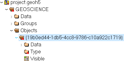
Objects are containers for Data with spatial information.
Most (not all) object geometry is described in terms of vertices (3D
locations) and cells (groupings of vertices such as triangles or
segments). The exact requirements and interpretation depends on the
type.
Attributes
- Name:
strName of the object displayed in the project tree.- ID:
strUnique identifier (UUID) of the group.- Visible:
int, 0 or (default) 1 Set visible in the 3D camera (checked in the object tree).- Public:
int, 0 or (default) 1 Set accessible in the object tree and other parts of the the user interface.- Clipping IDs:
1D array of
UUID(Optional) List of unique identifiers of clipping plane objects.- Allow delete:
int, 0 or (default) 1 (Optional) User interface allows deletion.- Allow move:
int, 0 or (default) 1 (Optional) User interface allows moving to another parent group.- Allow rename:
int, 0 or (default) 1 (Optional) User interface allows renaming.- Metadata:
(
int, optional) (Optional) Any additional text attached to the group.
The following section describes the supported object types and their specific attributes.
Points#
UUID : {202C5DB1-A56D-4004-9CAD-BAAFD8899406}
3-D scatter points object defined by vertices with fixed coordinates in Cartesian system (x, y and z).
Datasets#
- Vertices:
1D composite array
[x
double, ydouble, zdouble]
Curve#
UUID : {6A057FDC-B355-11E3-95BE-FD84A7FFCB88}
Polyline object defined by a series of line segments (cells) connecting vertices. Data can be associated to either the vertices or cells.
Attributes#
- Current line property ID:
str, UUIDUnique identifier of a reference data for naming of curve parts.
Datasets#
- Cells:
Array of
int32, shape(N, 2)Array defining the connection (line segment) between pairs of vertices.
Surface#
UUID : {F26FEBA3-ADED-494B-B9E9-B2BBCBE298E1}
Triangulated mesh object defined by cells (triangles) and vertices.
Datasets#
- Cells:
Array of
int32, shape(N, 3)Array defining the connection between triplets of vertices, representing triangles.
Block model#
UUID : {B020A277-90E2-4CD7-84D6-612EE3F25051}
Rectilinear grid of cells defined along three orthogonal axes (U,V and Z) of length nU, nV and nZ respectively. The conversion between the array coordinates of a cell to a 1-D vector index can be calculated from
cell index = k + i*nZ + j*nU*nZ
Without rotation angles, U points eastwards, V points northwards, and Z points upwards.
Since their geometry is defined entirely by the additional data described below, block models do not require a Vertices or Cells dataset.
Datasets#
- U cell delimiters:
array of
double, shape(nU,)Distances of cell edges from origin along the U axis (first value should be 0)
- V cell delimiters:
array of
double, shape(nV,)Distances of cell edges from origin along the V axis (first value should be 0)
- Z cell delimiters:
array of
double, shape(nZ,)Distances of cell edges from origin upwards along the vertical axis (first value should be 0)
Attributes#
- Origin:
composite type
[X
double, Ydouble, Zdouble]Origin point of grid
- Rotation:
double(default) 0 Counterclockwise angle (degrees) of rotation around the vertical axis in degrees.
2D Grid#
UUID : {48f5054a-1c5c-4ca4-9048-80f36dc60a06}
Rectilinear grid of cells defined along two orthogonal axes (U and V) of length nU and nV. The conversion between the grid coordinates of a cell to its 1-D vector index can be calculated from
cell index = i + j*nU
Without rotation angles, U points eastwards and V points northwards. Since their geometry is defined entirely by the additional data described below, 2D grids do not require a Vertices or Cells dataset.
Attributes#
- Origin:
composite type
[X
double, Ydouble, Zdouble]Origin point of the grid.
- U Size:
doubleLength of U axis- U Count:
doubleNumber of cells along U axis- V Size:
doubleLength of V axis- V Count:
doubleNumber of cells along V axis- Rotation:
double(Optional) Counterclockwise angle (degrees) of rotation around the vertical axis at the Origin.- Vertical:
char, 0(false, default) or 1(true)) (Optional) If true, V axis is vertical (and rotation defined around the V axis)
Drillhole#
UUID : {7CAEBF0E-D16E-11E3-BC69-E4632694AA37}
Object representing boreholes defined by a collar location and survey parameters.
Vertices represent points along the drillhole path (support for data rather than the drillhole geometry itself) and must have a Depth property value.
Cells contain two vertices and represent intervals along the drillhole path (and are a support for interval data as well).
Cells may overlap with each other to accommodate the different sampling intervals of various data.
Attributes#
- Collar:
composite type, shape(3,)
[X
double, Ydouble, Zdouble]Collar location
Datasets#
- Surveys:
composite array, shape(3,)
[Depth
double, Dipdouble, Azimuthdouble]Survey locations
- Trace:
1D composite array
[X
double, Ydouble, Zdouble]Points forming the drillhole path from collar to end of hole. Must contain at least two points.
Geoimage#
UUID : {77AC043C-FE8D-4D14-8167-75E300FB835A}
Not yet geoh5py implemented
To be further documented
Vertices represent the four corners of the geolocated image. No cell data. An object-associated file-type data containing the image to display is expected to exist under this object.
Note
Should be arranged as a rectangle currently, since Geoscience ANALYST does not currently support skewed images.
Label#
UUID : {E79F449D-74E3-4598-9C9C-351A28B8B69E}
Not yet geoh5py implemented
To be further documented
Has no vertices nor cell data
Attributes#
- Target position:
composite type, shape(3,)
[X
double, Ydouble, Zdouble]The target location of the label
- Label position:
composite type, shape(3,)
[X
double, Ydouble, Zdouble] (Optional - Defaults to same as target position ) The location where the text of the label is displayed
Slicer#
UUID : {238f961d-ae63-43de-ab64-e1a079271cf5}
Not yet geoh5py implemented
To be further documented
Target#
UUID : {46991a5c-0d3f-4c71-8661-354558349282}
Not yet geoh5py implemented
To be further documented
ioGAS Points#
UUID : {d133341e-a274-40e7-a8c1-8d32fb7f7eaf}
Not yet geoh5py implemented
To be further documented
Maxwell Plate#
UUID : {878684e5-01bc-47f1-8c67-943b57d2e694}
Not yet geoh5py implemented
To be further documented
Octree#
UUID : {4ea87376-3ece-438b-bf12-3479733ded46}
Semi-structured grid that stores cells in a tree structure with eight octants.
Datasets#
- Octree Cells:
composite type, shape(N, 4)
[I
integer, Jinteger, Kinteger, NCellsinteger]Array defining the position (I, J, K) and size (NCells) of every cell within the base octree grid.
Attributes#
- NU:
integerNumber of base cells along the U-axis.- NV:
integerNumber of base cells along the V-axis.- NW:
integerNumber of base cells along the W-axis.- Origin:
composite type, shape(3,)
[X
double, Ydouble, Zdouble]Origin point of the grid.
- Rotation:
double(default) 0 Counterclockwise angle (degrees) of rotation around the vertical axis in degrees.- U Cell Size:
doubleBase cell dimension along the U-axis.- V Cell Size:
doubleBase cell dimension along the V-axis.- W Cell Size:
doubleBase cell dimension along the W-axis.
Text Object#
UUID : {c00905d1-bc3b-4d12-9f93-07fcf1450270}
Not yet geoh5py implemented
To be further documented
Potential Electrode#
UUID : {275ecee9-9c24-4378-bf94-65f3c5fbe163}
Curve object representing the receiver electrodes of a direct-current resistivity survey.
Datasets#
- Metadata:
json formatted
stringDictionary defining the link between the source and receiver objects.
“Current Electrodes”
uuid: Identifier for the linked Current Electrode“Potential Electrodes”
uuid: Identifier for the linked Potential Electrode
Requirements#
- A-B Cell ID:
Data entity
Reference data named “A-B Cell ID” with
association=CELLexpected. The values define the source dipole (cell) from the Current Electrode to every potential measurement.
Current Electrode#
UUID : {9b08bb5a-300c-48fe-9007-d206f971ea92}
Curve object representing the transmitter electrodes of a direct-current resistivity survey.
Datasets#
- Metadata:
json formatted
stringDictionary defining the link between the source and receiver objects. Same definition as the Potential Electrode object.
Requirements#
- A-B Cell ID:
Data entity
Reference data named “A-B Cell ID” with
association=CELLdefining a unique identifier to every unique dipole sources. For “pole” sources, thecellattribute references twice to the same vertex.
VP Model#
UUID : {7d37f28f-f379-4006-984e-043db439ee95}
Not yet geoh5py implemented
To be further documented
Airborne TEM Rx#
UUID : {19730589-fd28-4649-9de0-ad47249d9aba}
Curve object representing an array of time-domain electromagnetic receiver dipoles.
Attributes#
- SurveyCost:
double
Datasets#
- Metadata:
json formatted
stringDictionary of survey parameters shared with the Transmitters. The following items are core parameters stored under the “EM Dataset” key.
- “Channels”:
listofdouble Time channels at which data are recorded.
- “Channels”:
- “Input type”:
string Type of survey from “Rx”, “Tx” or “Tx and Rx”
- “Input type”:
- “Loop radius”:
double Transmitter loop radius.
- “Loop radius”:
- “Property groups”:
listofuuid Reference to property groups containing data at every channel.
- “Property groups”:
- “Receivers”:
uuid Unique identifier referencing to itself.
- “Receivers”:
- “Survey type”:
string Defaults to “Airborne TEM”.
- “Survey type”:
- “Transmitters”:
uuid Unique identifier referencing to the linked transmitters entity.
- “Transmitters”:
- “Unit”:
string Sampling units, must be one of “Seconds (s)”, “Milliseconds (ms)”, “Microseconds (us)” or “Nanoseconds (ns)”.
- “Unit”:
- “Crossline offset property”
uuidOR “Crossline offset value”double: Offline offset between the receivers and transmitters, either defined locally on vertices as a
propertyOR globally as a constantvalue.
- “Crossline offset property”
- “Inline offset property”
uuidOR “Crossline offset value”double: Inline offset between the receivers and transmitters, either defined locally on vertices as a
propertyOR globally as a constantvalue.
- “Inline offset property”
- “Yaw property”
uuidOR “Yaw value”double: Rotation (angle) of the transmitter loop as measured on the UV-plane (+ clockwise), either defined locally on vertices as a
propertyOR globally as a constantvalue.
- “Yaw property”
- “Pitch property”
uuidOR “Pitch value”double: Tilt angle of the transmitter loop as measured on the VW-plane (+ nose up), either defined locally on vertices as a
propertyOR globally as a constantvalue.
- “Pitch property”
- “Roll property”
uuidOR “Roll value”double: Banking angle of the transmitter loop as measured on the UW-plane (+ right-wing down), either defined locally on vertices as a
propertyOR globally as a constantvalue.
- “Roll property”
- “Waveform”
dict: - “Discretization” array of
double, shape(N, 2): Array of times and normalized currents (Amp) describing the source impulse over a discrete interval (e.g. [[t_1, c_1], [t_2, c_2], …, [t_N, c_N]])
- “Discretization” array of
- “Timing mark”
double: Reference timing mark measured from the beginning of the “Discretization”. Generally used as the reference (t_i=0.0) for the provided data channels: (-) on-time an (+) off-time.
- “Timing mark”
- “Waveform”
Airborne TEM Tx#
UUID : {58c4849f-41e2-4e09-b69b-01cf4286cded}
Curve object representing an array of time-domain electromagnetic transmitter loops.
Datasets#
- Metadata:
json formatted
stringSee definition from the Airborne TEM Rx object. The “Transmitters”
uuidvalue should point to itself, while the “Receivers”uuidrefers the linked Airborne TEM Rx object.
Moving Loop Ground TEM Rx#
UUID : {41018a45-01a0-4c61-a7cb-9f32d8159df4}
Curve object representing an array of time-domain electromagnetic moving receiver dipoles.
Attributes#
- SurveyCost:
double
Datasets#
- Metadata:
json formatted
stringDictionary of survey parameters shared with the Transmitters. The following items are core parameters stored under the “EM Dataset” key.
- “Channels”:
listofdouble Time channels at which data are recorded.
- “Channels”:
- “Input type”:
string Type of survey from “Rx”, “Tx” or “Tx and Rx”
- “Input type”:
- “Loop radius”:
double Transmitter loop radius.
- “Loop radius”:
- “Property groups”:
listofuuid Reference to property groups containing data at every channel.
- “Property groups”:
- “Receivers”:
uuid Unique identifier referencing to itself.
- “Receivers”:
- “Survey type”:
string Defaults to “Ground TEM”.
- “Survey type”:
- “Transmitters”:
uuid Unique identifier referencing to the linked transmitters entity.
- “Transmitters”:
- “Unit”:
string Sampling units, must be one of “Seconds (s)”, “Milliseconds (ms)”, “Microseconds (us)” or “Nanoseconds (ns)”.
- “Unit”:
- “Waveform”
dict: - “Discretization” array of
double, shape(N, 2): Array of times and normalized currents (Amp) describing the source impulse over a discrete interval (e.g. [[t_1, c_1], [t_2, c_2], …, [t_N, c_N]])
- “Discretization” array of
- “Timing mark”
double: Reference timing mark measured from the beginning of the “Discretization”. Generally used as the reference (t_i=0.0) for the provided data channels: (-) on-time an (+) off-time.
- “Timing mark”
- “Waveform”
Moving Loop Ground TEM Tx#
UUID : {98a96d44-6144-4adb-afbe-0d5e757c9dfc}
Curve object representing an array of time-domain electromagnetic moving transmitter loops.
Datasets#
- Metadata:
json formatted
stringSee definition from the Moving Loop Ground TEM Rx object. The “Transmitters”
uuidvalue should point to itself, while the “Receivers”uuidrefers the linked Moving Loop Ground TEM Rx object.
Ground TEM Rx (large-loop)#
UUID : {deebe11a-b57b-4a03-99d6-8f27b25eb2a8}
Curve object representing an array of frequency-domain electromagnetic receiver dipoles.
Datasets#
- Metadata:
json formatted
stringDictionary of survey parameters shared with the Transmitters. The following items are core parameters stored under the “EM Dataset” key.
- “Channels”:
listofdouble Time channels at which data are recorded.
- “Channels”:
- “Input type”:
string “Tx and Rx”
- “Input type”:
- “Property groups”:
listofuuid Reference to property groups containing data at every channel.
- “Property groups”:
- “Receivers”:
uuid Unique identifier referencing to itself.
- “Receivers”:
- “Survey type”:
string Defaults to “Ground TEM (large loop)”.
- “Survey type”:
- “Transmitters”:
uuid Unique identifier referencing to the linked transmitters entity.
- “Transmitters”:
- “Tx ID property”:
uuid Reference to a property containing the transmitter ID for every receiver.
- “Tx ID property”:
- “Unit”:
string Sampling units, must be one of “Seconds (s)”, “Milliseconds (ms)”, “Microseconds (us)” or “Nanoseconds (ns)”.
- “Unit”:
- “Waveform”
dict: - “Discretization” array of
double, shape(N, 2): Array of times and normalized currents (Amp) describing the source impulse over a discrete interval (e.g. [[t_1, c_1], [t_2, c_2], …, [t_N, c_N]])
- “Discretization” array of
- “Timing mark”
double: Reference timing mark measured from the beginning of the “Discretization”. Generally used as the reference (t_i=0.0) for the provided data channels: (-) on-time an (+) off-time.
- “Timing mark”
- “Waveform”
Ground TEM Tx (large-loop)#
UUID : {17dbbfbb-3ee4-461c-9f1d-1755144aac90}
Curve object representing an array of time-domain electromagnetic large transmitter loops.
Datasets#
- Metadata:
json formatted
stringSee definition from the Ground TEM Rx (large-loop) object. The “Transmitters”
uuidvalue should point to itself, while the “Receivers”uuidrefers the linked Ground TEM Rx (large-loop) object.
Airborne FEM Rx#
UUID : {b3a47539-0301-4b27-922e-1dde9d882c60}
Curve object representing an array of frequency-domain electromagnetic receiver dipoles.
Attributes#
- SurveyCost:
double
Datasets#
- Metadata:
json formatted
stringDictionary of survey parameters shared with the Transmitters. The following items are core parameters stored under the “EM Dataset” key.
- “Channels”:
listofdouble Frequency channels at which data are recorded.
- “Channels”:
- “Input type”:
string Type of survey from “Rx”, “Tx” or “Tx and Rx”
- “Input type”:
- “Loop radius”:
double Transmitter loop radius.
- “Loop radius”:
- “Property groups”:
listofuuid Reference to property groups containing data at every channel.
- “Property groups”:
- “Receivers”:
uuid Unique identifier referencing to itself.
- “Receivers”:
- “Survey type”:
string Defaults to “Airborne TEM”.
- “Survey type”:
- “Transmitters”:
uuid Unique identifier referencing to the linked transmitters entity.
- “Transmitters”:
- “Unit”:
string Sampling units, must be one of “”Hertz (Hz)”, “KiloHertz (kHz)”, “MegaHertz (MHz)” or “Gigahertz (GHz)”.
- “Unit”:
- “Crossline offset property”
uuidOR “Crossline offset value”double: Offline offset between the receivers and transmitters, either defined locally on vertices as a
propertyOR globally as a constantvalue.
- “Crossline offset property”
- “Inline offset property”
uuidOR “Crossline offset value”double: Inline offset between the receivers and transmitters, either defined locally on vertices as a
propertyOR globally as a constantvalue.
- “Inline offset property”
- “Yaw property”
uuidOR “Yaw value”double: Rotation (angle) of the transmitter loop as measured on the UV-plane (+ clockwise), either defined locally on vertices as a
propertyOR globally as a constantvalue.
- “Yaw property”
- “Pitch property”
uuidOR “Pitch value”double: Tilt angle of the transmitter loop as measured on the VW-plane (+ nose up), either defined locally on vertices as a
propertyOR globally as a constantvalue.
- “Pitch property”
- “Roll property”
uuidOR “Roll value”double: Banking angle of the transmitter loop as measured on the UW-plane (+ right-wing down), either defined locally on vertices as a
propertyOR globally as a constantvalue.
- “Roll property”
Airborne FEM Tx#
UUID : {a006cf3e-e24a-4c02-b904-2e57b9b5916d}
Curve object representing an array of frequency-domain electromagnetic transmitter loops.
Datasets#
- Metadata:
json formatted
stringSee definition from the Airborne FEM Rx object. The “Transmitters”
uuidvalue should point to itself, while the “Receivers”uuidrefers the linked Airborne FEM Rx object.
Moving Loop Ground FEM Rx#
UUID : {a81c6b0a-f290-4bc8-b72d-60e59964bfe8}
Curve object representing an array of frequency-domain electromagnetic moving receiver dipoles.
Attributes#
- SurveyCost:
double
Datasets#
- Metadata:
json formatted
stringDictionary of survey parameters shared with the Transmitters. The following items are core parameters stored under the “EM Dataset” key.
- “Channels”:
listofdouble Frequency channels at which data are recorded.
- “Channels”:
- “Input type”:
string Type of survey from “Rx”, “Tx” or “Tx and Rx”
- “Input type”:
- “Loop radius”:
double Transmitter loop radius.
- “Loop radius”:
- “Property groups”:
listofuuid Reference to property groups containing data at every channel.
- “Property groups”:
- “Receivers”:
uuid Unique identifier referencing to itself.
- “Receivers”:
- “Survey type”:
string Defaults to “Ground FEM”.
- “Survey type”:
- “Transmitters”:
uuid Unique identifier referencing to the linked transmitters entity.
- “Transmitters”:
- “Unit”:
string Sampling units, must be one of “”Hertz (Hz)”, “KiloHertz (kHz)”, “MegaHertz (MHz)” or “Gigahertz (GHz)”.
- “Unit”:
Moving Loop Ground FEM Tx#
UUID : {f59d5a1c-5e63-4297-b5bc-43898cb4f5f8}
Curve object representing an array of frequency-domain electromagnetic moving transmitter loops.
Datasets#
- Metadata:
json formatted
stringSee definition from the Moving Loop Ground FEM Rx object. The “Transmitters”
uuidvalue should point to itself, while the “Receivers”uuidrefers the linked Moving Loop Ground FEM Rx object.
Ground FEM Rx (large-loop)#
UUID : {30928322-cf2c-4230-b393-4dc629259b64}
Curve object representing an array of frequency-domain electromagnetic receiver dipoles.
Datasets#
- Metadata:
json formatted
stringDictionary of survey parameters shared with the Transmitters. The following items are core parameters stored under the “EM Dataset” key.
- “Channels”:
listofdouble Frequency channels at which data are recorded.
- “Channels”:
- “Input type”:
string “Tx and Rx”
- “Input type”:
- “Property groups”:
listofuuid Reference to property groups containing data at every channel.
- “Property groups”:
- “Receivers”:
uuid Unique identifier referencing to itself.
- “Receivers”:
- “Survey type”:
string Defaults to “Ground FEM (large loop)”.
- “Survey type”:
- “Transmitters”:
uuid Unique identifier referencing to the linked transmitters entity.
- “Transmitters”:
- “Tx ID property”:
uuid Reference to a property containing the transmitter ID for every receiver.
- “Tx ID property”:
- “Unit”:
string Sampling units, must be one of “”Hertz (Hz)”, “KiloHertz (kHz)”, “MegaHertz (MHz)” or “Gigahertz (GHz)”.
- “Unit”:
Ground FEM Tx (large-loop)#
UUID : {fe1a240a-9189-49ff-aa7e-6067405b6e0a}
Curve object representing an array of frequency-domain electromagnetic large transmitter loops.
Datasets#
- Metadata:
json formatted
stringSee definition from the Ground FEM Rx (large-loop) object. The “Transmitters”
uuidvalue should point to itself, while the “Receivers”uuidrefers the linked Ground FEM Rx (large-loop) object.
Magnetotellurics#
UUID : {b99bd6e5-4fe1-45a5-bd2f-75fc31f91b38}
Points object representing a magnetotelluric survey.
- Metadata:
json formatted
stringDictionary of survey parameters. The following items are core parameters stored under the “EM Dataset” key.
- “Channels”:
listofdouble Frequency channels at which data are recorded.
- “Channels”:
- “Input type”:
string Static field set to “Rx only”
- “Input type”:
- “Property groups”:
listofuuid Reference to property groups containing data at every channel.
- “Property groups”:
- “Receivers”:
uuid Reference to itself.
- “Receivers”:
- “Survey type”:
string Static field set to “Magnetotellurics”
- “Survey type”:
- “Unit”:
string Sampling units, must be one of “Hertz (Hz)”, “KiloHertz (kHz)”, “MegaHertz (MHz)” or “Gigahertz (GHz)”.
- “Unit”:
Tipper Rx#
UUID : {0b639533-f35b-44d8-92a8-f70ecff3fd26}
Curve object representing a tipper survey.
- Metadata:
json formatted
stringDictionary of survey parameters. The following items are core parameters stored under the “EM Dataset” key.
- “Channels”:
listofdouble Frequency channels at which data are recorded.
- “Channels”:
- “Input type”:
string Static field set to “Rx and base stations”
- “Input type”:
- “Property groups”:
listofuuid Reference to property groups containing data at every channel.
- “Property groups”:
- “Receivers”:
uuid Reference to itself.
- “Receivers”:
- “Base stations:
uuid Reference to Tipper Base stations
- “Base stations:
- “Survey type”:
string Static field set to “Magnetotellurics”
- “Survey type”:
- “Unit”:
string Sampling units, must be one of “Hertz (Hz)”, “KiloHertz (kHz)”, “MegaHertz (MHz)” or “Gigahertz (GHz)”.
- “Unit”:
Tipper Base stations#
UUID : {f495cd13-f09b-4a97-9212-2ea392aeb375}
Points object representing a tipper survey.
Airborne Gravity#
UUID : {b54f6be6-0eb5-4a4e-887a-ba9d276f9a83}
Not yet geoh5py implemented
To be further documented
Airborne Magnetics#
UUID : {4b99204c-d133-4579-a916-a9c8b98cfccb}
Not yet geoh5py implemented
To be further documented
Ground Gravity#
UUID : {5ffa3816-358d-4cdd-9b7d-e1f7f5543e05}
Not yet geoh5py implemented
To be further documented
Ground Magnetics#
UUID : {028e4905-cc97-4dab-b1bf-d76f58b501b5}
Not yet geoh5py implemented
To be further documented
Ground Gradient IP#
UUID : {68b16515-f424-47cd-bb1a-a277bf7a0a4d}
Not yet geoh5py implemented
To be further documented